Innovating sustainable solutions through digitalization, automation, and AI-driven analytics for energy, water, and environmental sectors.
Our Success Story.
Subsurface Intelligence: Geophysical Processing and Interpretation for Groundwater Exploration
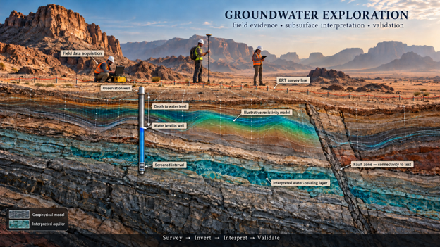
Where should the investigation wells go? AuroraTech answered that question from existing geophysical data. We processed and inverted vertical electrical sounding, electrical resistivity tomography and time-domain electromagnetic measurements, applied rigorous quality control, and interpreted the resistivity models together with the regional geology to map structures and the formations most likely to hold water, with an indicative depth to groundwater along each profile. The client received interpretation maps, cross-sections and a technical report written to feed directly into their geological assessment.
Outcome: geological structures and candidate aquifer units mapped, and an indicative depth to groundwater delivered across the study area, giving the client a defensible basis for siting investigation wells.