Innovating sustainable solutions through digitalization, automation, and AI-driven analytics for energy, water, and environmental sectors.
Our Success Story.
Monitoring: Hydrological Data Management and Flood Risk Mapping
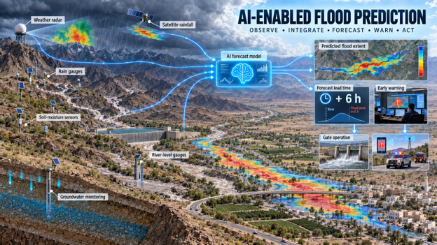
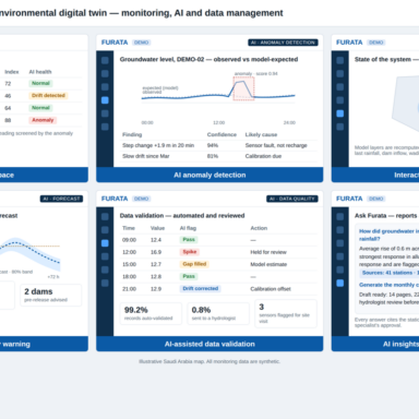
A monitoring network is only as useful as the decisions made from it. AuroraTech manages and analyses the groundwater and rainfall records of a hydrological network and turns them into operational information. Incoming data are validated and quality-assured; groundwater levels and quality are analyzed; rainfall is processed and tested for trends; and the response of groundwater to rainfall events is evaluated to understand recharge and flood behavior. Flood hazard and risk maps are developed and periodically updated, and regular technical reports flag monitoring trends, data-quality problems and the areas that need attention next.
Outcome: a validated, continuously maintained hydrological record, current flood risk maps, and periodic recommendations that the client uses for water-resources planning and flood preparedness.