Innovating sustainable solutions through digitalization, automation, and AI-driven analytics for energy, water, and environmental sectors.
Our Success Story.
Offshore Freshened Groundwater: Potentiality Mapping and Utilisation Feasibility (EU funded)
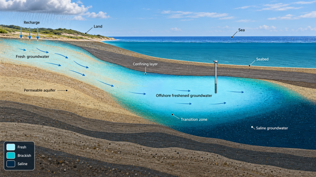
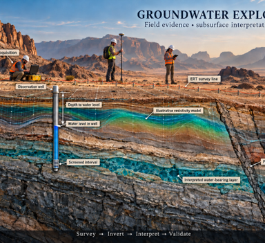
Coastal regions facing water stress have an unexplored resource beneath the seabed. In a feasibility screen funded by the European Union through a COST Action research mission, AuroraTech assessed offshore freshened groundwater as a new water source for the Akrotiri Peninsula. We built a GIS multi-criteria potentiality map combining onshore and offshore hydrogeology, faults, drainage, seabed geology and bathymetry with environmental and land-use constraints (protected areas, archaeology, ports, the airport, tourism), characterized the hydro-stratigraphy, groundwater levels, hydrochemistry and submarine groundwater discharge of the selected corridor, estimated exploitable volumes and salinity for a shallow sedimentary and a deeper karst aquifer scenario using Mediterranean analogues and sensitivity analysis, compared abstraction by subsea wells and horizontal directional drilling from shore, and assessed the desalination business case on energy consumption with an uncertainty analysis.
Outcome: one optimum corridor identified east of Marathi beach; exploitable volumes per kilometer of shoreline quantified for both aquifer scenarios, with porosity as the controlling uncertainty; brackish feedwater of about 2,000 ppm shown to cut desalination energy demand by up to 80 percent and energy cost by roughly 40 to 45 percent against seawater; and a staged site-investigation and 3D modelling roadmap for the next phase.